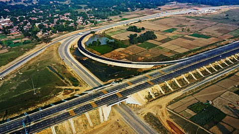
Road Safety Initiatives On The Bundelkhand Expressway To Be Amongst World’s Safest
New Delhi/Lucknow/ Nov 13 (TNA) The 296-Km Bundelkhand Expressway which will be linking the districts of Chitrakoot, Banda, Mahoba, Hamirpur Jalaun, Auraiya and Etawah with each other in the Uttar Pradesh State with aim of to minimize travel time is all set to be amongst the world’s safest expressways.
Falling under the purview of the Uttar Pradesh Expressways Industrial Development Authority (UPEIDA), the Bundelkhand Expressway is a four-lane under construction Expressway with a design speed of 120 kmph will be ushering in economic growth in the Eastern UP region.
The construction of the Expressway is divided into 6 packages being executed in a synchronised manner by experienced Concessionaires, which include APCO Infrastructure, Ashoka Buildcon, Gawar Construction and Dilip Buildcon.
“With 50 percent of the construction being complete, the International Road Federation – India chapter (IRF), a not-for-profit organisation is working towards making this Expressway one of the safest in the world. The objective of the IRF-IC’s effort is to put in place an Expressway Stretch which will have a forgiving nature with almost zero fatalities and serious injuries in case of road crashes. “ said Satish Parakh, President, International Road Federation (India Chapter)
“IRF is working on the global concept of Forgiving Road which aims at avoiding / minimising the harm and consequences of traffic accidents using different innovative technologies. The exercise will be done through series of road safety management measures based on Engineering, Education, Enforcement and Emergency” K K Kapila, President, Emeritus, International Road Federation said.
IRF-IC’s interventions include road safety education to school children/teachers covering institutions in the 2 Km radius on either side of the road stretch. These have already been mapped and enumerated. Besides this, as part of the Enforcement initiatives, training of Police Personnel on use of Accident Data Collection software called RADaR developed by IRF-IC and Traffic Management will be undertaken in association with the Institute of Road Traffic Education (IRTE).
For this activity, Police Stations in the 2 Km radius on either side of the road stretch which have been mapped, will be covered.
Emergency Care is another area where IRF-IC will undertake initiatives. Hospitals and medical facilities spanning 5 Km radius on either side of the road stretch have been mapped. After enumeration, we will undertake training programme on first aid trauma care and on being a good Samaritan.

